Wildfires are an ever-present threat that challenge emergency services, especially firefighters tasked with containing these dangerous blazes. When a wildfire jumps containment lines, swift decision-making becomes crucial. Firefighters are trained to follow predetermined escape routes, but the reliance on experience and basic terrain knowledge often leaves them inadequately prepared for the unpredictable nature of wildfires. The urgency of the situation is palpable—when firefighters check their watches during an evacuation, they are not just monitoring time; they are acutely aware that every second counts.
Current evacuation strategies primarily consider the steepness of terrain when estimating travel times. Such models oversimplify the complexities of nature, ignoring factors like vegetation density and ground surface roughness, both of which can significantly influence how quickly someone can move through an environment. The need for a comprehensive tool that accounts for all these variables is not merely theoretical; it is essential for enhancing the safety of those on the front lines.
The groundbreaking study conducted by researchers at the University of Utah introduces a powerful model called Simulating Travel Rates in Diverse Environments (STRIDE). STRIDE marks a significant advancement in the study of firefighter mobility by integrating ground roughness and vegetation density with slope steepness to establish more accurate travel times. According to lead author Mickey Campbell, understanding mobility is paramount for firefighters: “If I’m in the middle of the woods and need to get out of here, what is the best way to go and how long will it take me?”
The researchers employed advanced Light Detection and Ranging (LiDAR) technology, which uses laser pulses to gather intricate data about the landscape. This method generates high-resolution three-dimensional maps that accurately reflect terrain features. By synthesizing LiDAR data with field trials, the researchers formulated an intuitive equation to identify efficient routes in a variety of settings, from dense forests to urban landscapes.
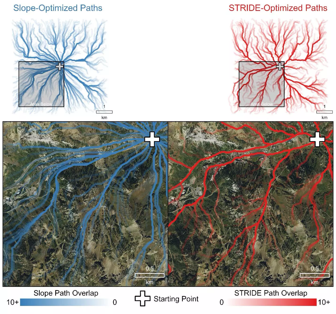
A key find during the development of STRIDE is its remarkable ability to predict travel routes that align closely with those a person might instinctively take. The model consistently favors established paths like roads and trails, opted by users seeking the path of least resistance. This level of accuracy surpasses traditional models, which often underestimate travel times due to their singular focus on slope.
One of the most sobering aspects of firefighter operations is the real risk posed during evacuations. Historical incidents, such as the tragic events of the Yarnell Hill fire in 2013, underscore the potentially fatal consequences of miscalculating evacuation routes. STRIDE not only aims to elevate firefighter safety but also intends to provide insights applicable across various fields—including defense, archaeology, disaster response, and outdoor recreational planning.
What makes STRIDE particularly compelling is the rigor of its validation process. The study compared STRIDE’s predictions against travel rates captured during field experiments involving volunteers traversing varied terrains. These trials featured different landscapes, including rugged mountainous regions and smooth urban environments, thus ensuring a comprehensive analysis.
The collaborative efforts of the researchers laid the groundwork for more effective emergency response strategies. In a practical application scenario, STRIDE outperformed other models by adeptly selecting routes that avoided hazardous vegetation and rugged surfaces, illustrating its profound understanding of human navigation in emergencies.
Moreover, it’s notable that STRIDE was not pre-loaded with information about existing transportation networks. The model’s ability to identify optimal paths based purely on inherent terrain properties speaks to its advanced algorithmic design.
In practical terms, STRIDE represents much more than an academic pursuit; it stands as a potentially transformative tool for emergency responders. With the model now publicly accessible, professionals across various fields can leverage its benefits, improving safety and operational efficiency.
Campbell highlights the significance of considering not just slope but also vegetation and surface material, suggesting that ignoring these elements can lead to significant underestimations of travel time. The support from the U.S. Forest Service for this research indicates the real-world implications of understanding firefighter mobility.
By updating existing emergency resources like the Ground Evacuation Time layer, Campbell envisions STRIDE contributing deeper insights into evacuation timelines across the United States. Improved accuracy can mean the difference between life and death for those caught in hazardous situations.
As fires become more frequent and intense due to climate change, the need for innovative solutions like STRIDE becomes more pressing. With this new approach, emergency responders can augment traditional evacuation methods by harnessing technology that prioritizes safety, maximizing efficiency, and enhancing the overall response to wildfires and other emergencies. The intersection of advanced research and real-world utility heralds a promising shift toward safer and more strategic evacuations in the face of nature’s unpredictability.

