Urban landscapes pose unique challenges for high-precision positioning systems. Global Navigation Satellite Systems (GNSS), particularly Real-Time Kinematic (RTK) systems, often struggle in the face of signal interruptions and distortions caused by buildings and other obstructions. This results in diminished accuracy and reliability, making it increasingly difficult to satisfy the growing demand for precise positioning in metropolitan areas. Traditional solutions have explored alternative technologies, including Wi-Fi and Bluetooth, but these methods frequently fall short. The emergence of 5G technology, with its superior speed, bandwidth, and density, offers a promising path forward to overcoming these urban positioning obstacles.
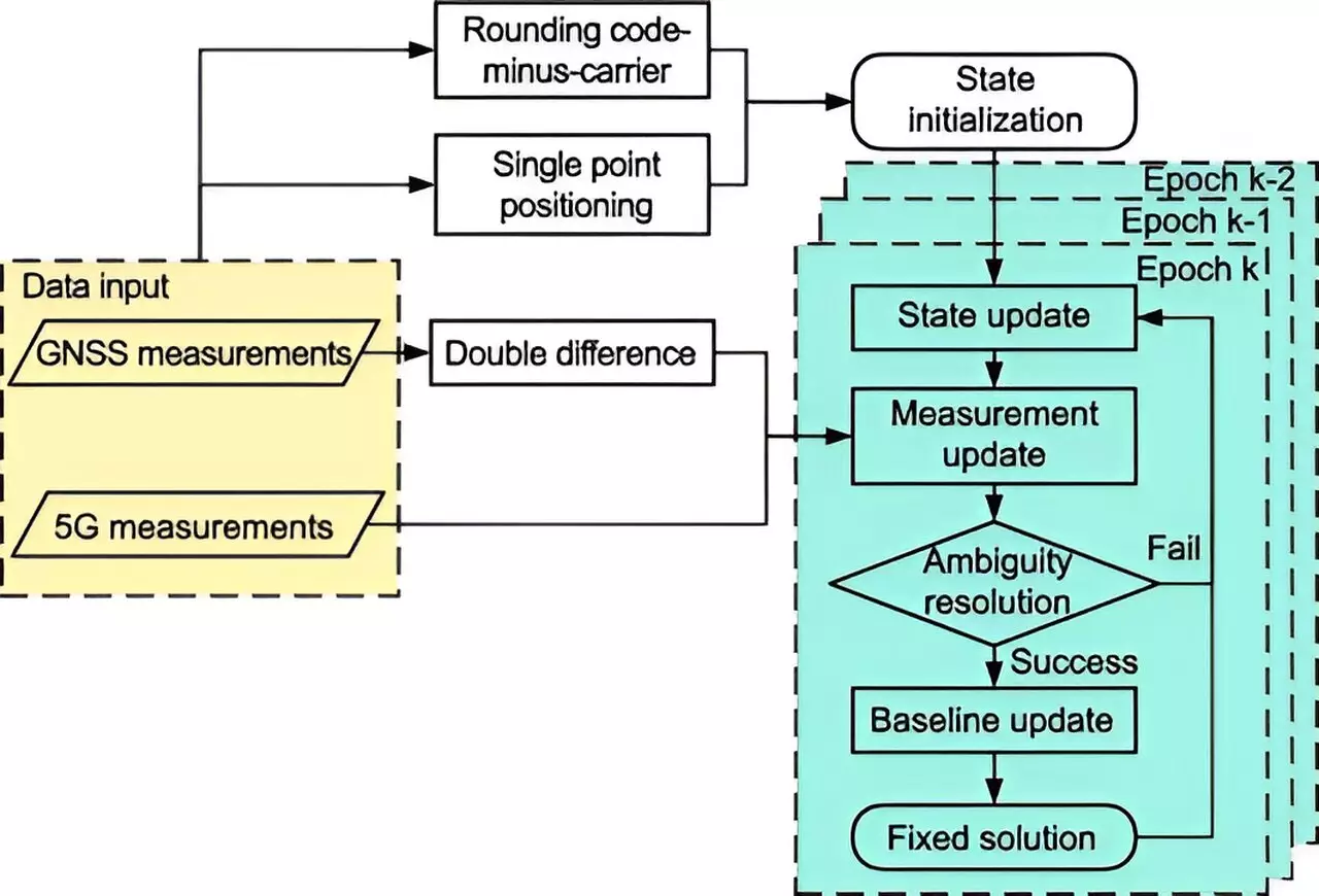
Recently, researchers at Tsinghua University have unveiled a groundbreaking integration of 5G technology with the BeiDou Navigation Satellite System (BDS) RTK positioning system. Published in Satellite Navigation on August 26, 2024, their study illustrates the profound advancements this new system brings to urban positioning. By巧妙地 combining 5G observations with conventional satellite data and employing advanced mathematical techniques such as the extended Kalman filter and sophisticated ambiguity resolution methods, they have significantly increased the accuracy of positioning in cluttered city environments.
The improved positioning capabilities were rigorously assessed using gain factors that helped quantify float solutions and the ambiguity dilution of precision (ADOP). Notably, the 5G-augmented BDS RTK system demonstrated remarkable improvements, achieving a reduction in spatial errors by nearly 48% in full ambiguity resolution mode (FAR) and approximately 18.8% in partial ambiguity resolution mode (PAR). Fixing rates also increased, illustrating the system’s enhanced performance metrics.
Dr. Tengfei Wang, a prominent figure in the study, highlighted the transformative impact of integrating 5G with BDS RTK technology. This integration not only systematically addresses long-standing issues related to urban navigation but also enhances signal clarity and maximizes satellite visibility. The implications are extensive, opening avenues for improved positioning solutions that cater to various modern applications, including autonomous vehicles, public safety initiatives, and the broader framework of smart city developments.
With 5G networks already widely deployed across urban centers, the research reveals an adaptable and scalable solution to enhance location-based services. This innovative system holds the potential to revolutionize how urban navigation is approached, particularly in areas where conventional methods have proven inefficient.
Future research efforts aim to test the limits of the 5G-BDS RTK integration across diverse real-world scenarios. Such investigations will refine the system further, enhancing its reliability and accuracy in urban contexts. As cities continue to grow and evolve, the need for precise navigation tools becomes increasingly vital. By leveraging the capabilities of 5G technology, the field of high-precision positioning is likely to witness notable advancements, ultimately leading to safer and more efficient urban environments. The transition towards smarter navigation systems heralds an exciting future in which technology plays a crucial role in addressing the complexities of urban living.

